skip to main
|
skip to sidebar
Map The Galaxy
Wednesday, August 6, 2008
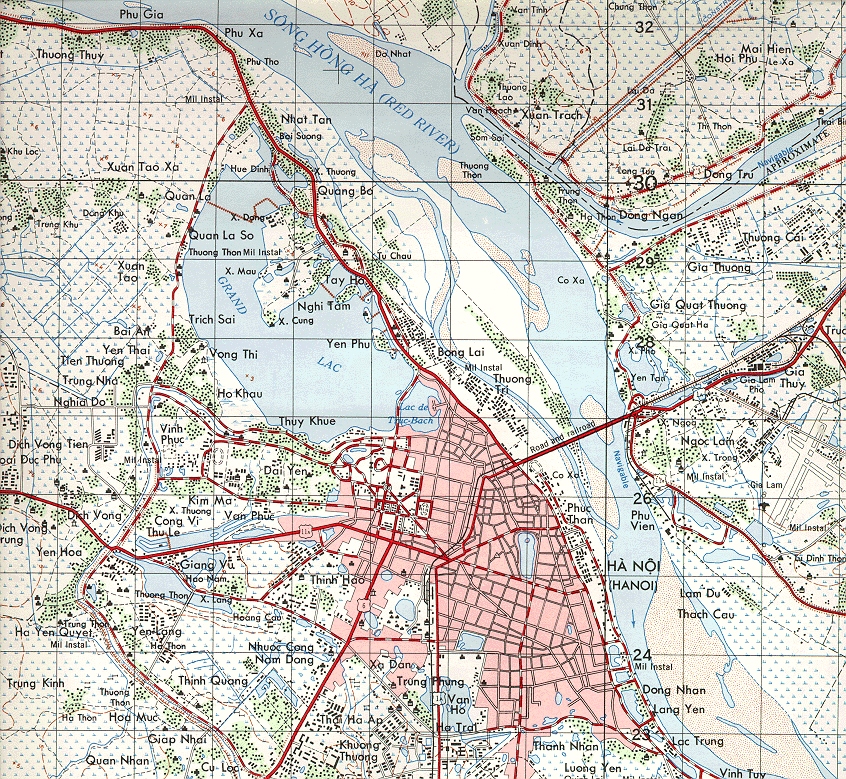
Planimetric
A planimetric map of Hanoi, Vietnam. Geographic features such as rivers, shorelines and vegetation, as well as roads and buildings are clearly identifiable. Notice no reference to elevation (topographic detail) is present.
Taken from
HERE
.
No comments:
Post a Comment
Newer Post
Older Post
Home
Subscribe to:
Post Comments (Atom)
Blog Archive
▼
2008
(58)
▼
August
(55)
Schematic
Periodic Table of Elements
Electrical Circuit
DNA Diagram
Timeline
Network Map
Array Map
Portolan Chart
Isopach
Bathymetric
Star Plot
Correlation Matrix
Similarity Matrix
Stem and Leaf Plot
Box Plot
Histogram
Parallel Coordinate Graph
Triangle Plot
Climograph
Population Profile
Scatter Plot
Index Value Plot
Lorenz Curve
Bilateral Graph
DOQQ
DEM
DLG
DRG
Isopleth
Isohyet
Isotach
Isobar
LIDAR
Dopler Radar
Infrared Aerial Photo
Cartographic Animation
Statistical Map
Cartogram
Flow Map
Isoline
Range Graded Proportional Circle
Continuous Variable Proportional Circle
Standardized Choropleth
Classed Choropleth
Unclassed Choropleth
Bivariate Choropleth
Univariate Choropleth
Dot Distribution
Propaganda Map
Hypsometric
PLSS
Cadastral
Thematic
Topographic
Planimetric
►
June
(2)
►
May
(1)
About Me
Rob Pierce
View my complete profile
No comments:
Post a Comment