A PLSS map of Franklin County, Alabama. 6 units of range and 3 units of township are shown. The area of detail is located southwest of the intersection of the baseline and principal meridian (initial point).
A thematic map charting the distribution of historical (yellow) and contemporary (red) cannibal populations circa the early 20th century. Note the lack of detailed physical geographic features. Emphasis is instead placed on spatial distribution of geographic populations.
A multispectral topographic map of my home island of Oahu, Hawai'i. A composite image was created from individual frames captured in various wavelengths from visible to infrared light. The final image clearly delineates the topographic features of the island, from the heights of the Ko'olau mountain range to the steeply sloped drop of the volcanic shoreline.
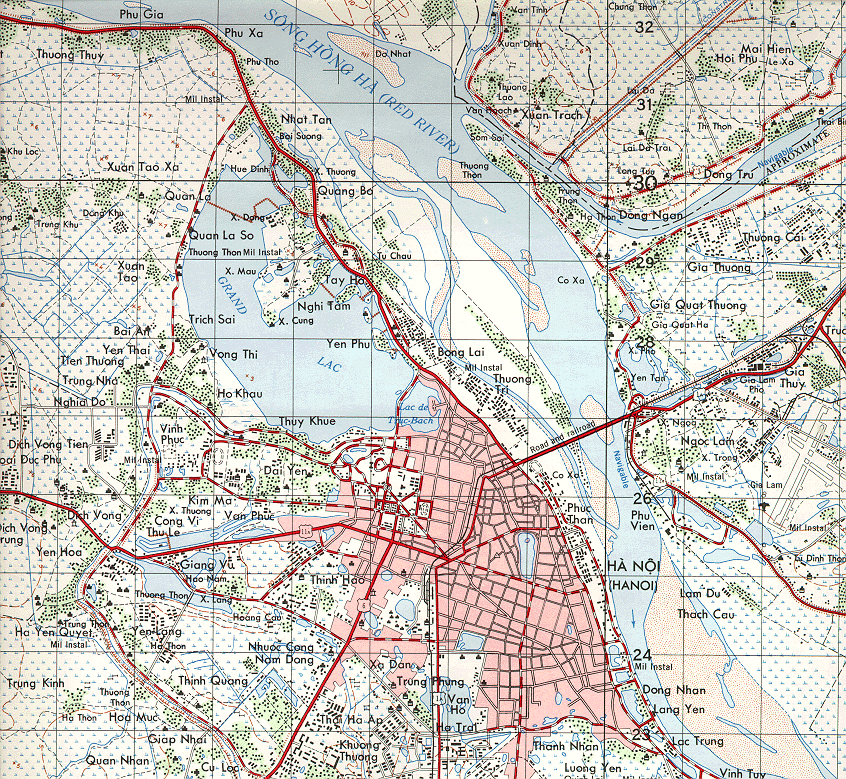
A planimetric map of Hanoi, Vietnam. Geographic features such as rivers, shorelines and vegetation, as well as roads and buildings are clearly identifiable. Notice no reference to elevation (topographic detail) is present.
An image representation of a mental map by the artist Franz Ackermann. Depicted among other things are both interiors and exteriors of buildings, a street map, a landscape and stylized flora.
A Google Earth image of a KMZ file representing population data for various refugee migration routes throughout Mogadishu, Somalia and the surrounding area. KMZ file taken from: Earth is Square: Mogadishu Refugee Migration